
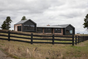
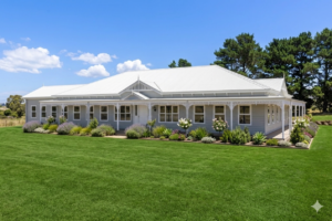
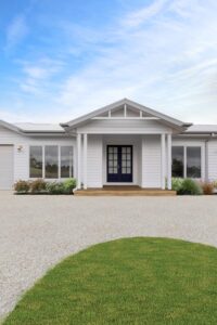
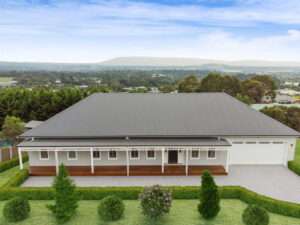
Romsey Primary School
Primary Main Street, Romsey VIC 3434Community primary school serving Romsey and surrounding districts
A mix of primary, secondary and early learning options keeps day-to-day life simple.
Community primary school serving Romsey and surrounding districts
Everyday shopping, pharmacies and cafes are a few minutes from the town centre.
Full-size supermarket opened 2025 with Liquorland, sustainability trial store
Butcher, fresh food deli, cafes, restaurants, hairdressers
Direct freeway access and V/Line services make commuting straightforward.
Coach services connecting to Sunbury, Lancefield and surrounding areas. No direct rail line.
Distance: Main Street
Main road access. Sunbury approximately 25km south. Melbourne CBD approximately 60km.
Parks, walking tracks and sporting reserves keep families outdoors.
Built around Five Mile Creek, playground and picnic facilities
Football, cricket, golf (18-hole course), bowls club
Local GPs and nearby hospitals mean you are not travelling far for care.
Click a row to view details
| Location | Population | To CBD | Train | Hospital | Supermarket | Schools | Parks |
|---|---|---|---|---|---|---|---|
Bullengarook 3437 | ~650 | ~68 km | 5 | 3 | |||
Health Services3 Nearest: Gisborne Medical Centres GP/Medical Centre Multiple medical practices in Gisborne, approximately 9km east Nearest: Bacchus Marsh Hospital Hospital Western Health hospital, approximately 21km south Nearest: Goonawarra Day Hospital Hospital Day hospital in Sunbury, approximately 23km Transport3 Nearest: Gisborne Station Train V/Line Bendigo Line, approximately 9km east. Services to Melbourne Southern Cross ~50 min. Nearest: Macedon Station Train V/Line Bendigo Line, approximately 10km north-east. Bacchus Marsh Road Road Main road through locality connecting Gisborne (14km) to Bacchus Marsh (19km). Melbourne via Calder Freeway approximately 68km. Schools & Childcare5 Sunbury & Macedon Ranges Specialist School (Senior Campus) Special Specialist school campus in former Bullengarook Primary School building (closed 2007) Nearest: Gisborne Primary School Primary Nearest primary school, approximately 7km east Nearest: St Brigid's Primary School Primary Catholic primary in Gisborne, approximately 7km east Nearest: Alice Miller School Secondary Independent school in Gisborne, approximately 6km east Nearest: Gisborne Secondary College Secondary Public secondary in Gisborne, approximately 6km east Shopping & Services3 No local shops Note Bullengarook is a rural locality with no commercial facilities. Residents travel to Gisborne for shopping. Nearest: Gisborne Shopping Shopping Full shopping precinct 9km east - Coles, Woolworths, FoodWorks, IGA, cafes, specialty stores Nearest: Bacchus Marsh Shopping Major shopping centre 19km south - Woolworths, Coles, Aldi Parks & Recreation3 Bullengarook Recreation Reserve Sporting Community reserve with tennis court, cricket ground, pavilion for hire, equestrian facilities, children's pony club Lerderderg State Park Nature Reserve Large state park with spectacular gorge, bushwalking, camping. Access via Blackwood or Bacchus Marsh. Mount Bullengarook Nature Local landmark, headwaters of Coimadai Creek Macedon Ranges Shire · Postcode 3437
View Location Profile | |||||||
Daylesford 3460 | ~2,800 | ~114 km | 4 | 6 | |||
Health Services4 Daylesford & District Hospital Hospital Public hospital with emergency, acute and aged care services Daylesford Medical Centre GP/Medical Centre General practice services Daylesford Dental Dentist General dentistry Darryl Wilson Optometrist Optometrist Established 1978, over 40 years experience Transport3 V/Line Coach Services Bus Coach services to Ballarat and Melbourne. No direct rail service. Daylesford Spa Country Railway Heritage Rail Heritage tourist railway operating between Daylesford and Bullarto. Scenic rides. Midland Highway / Ballan Road Road Melbourne CBD approximately 115km. Ballarat 45km. Nearest V/Line train station: Ballan. Schools & Childcare4 Daylesford Primary School Primary Community primary school serving Daylesford and district Daylesford Secondary College Secondary Public co-educational Years 7-12 secondary school St Michael's Primary School Primary Catholic primary school Daylesford Kindergarten Kindergarten Community kindergarten Shopping & Services7 IGA Daylesford Supermarket Main supermarket in town centre IGA Daylesford (Albert Street) Supermarket Second IGA location Blake Family Grocers Specialty Food Local produce, artisan delicacies, free-range meats, cheeses, gourmet groceries Cliffy's Emporium Specialty Legendary general store since 1950s, local produce, specialty groceries, kitchenware Vincent Street Precinct Shopping Main shopping strip with cafes, galleries, antiques, boutiques, bookshops Daylesford Pharmacy Pharmacy Community pharmacy Hepburn Wholefoods Collective Specialty Food Not-for-profit organic and biodynamic wholefoods from local farms Parks & Recreation6 Lake Daylesford Recreation Scenic lake with walking tracks, picnic areas, cafe, paddleboats Wombat Hill Botanic Gardens Botanic Garden Historic gardens atop volcanic hill, lookout tower, conifer collection Hepburn Mineral Springs Reserve Nature Reserve Natural mineral springs, walking trails, spa precinct 4km from Daylesford Jubilee Lake Recreation Swimming, picnic area, walking trails Wombat State Forest Nature Reserve Extensive forest for bushwalking, mountain biking, camping Daylesford Sunday Market Markets Popular weekly market every Sunday Hepburn Shire · Postcode 3460
View Location Profile | |||||||
Gisborne 3437 | ~14,500 | ~54 km | 5 | 5 | |||
Health Services5 Gisborne Medical Centre GP/Medical Centre Established 1979, allied health services available including psychology and physiotherapy Gisborne Medical Clinic GP/Medical Centre Bulk billing available with Medicare/DVA/Seniors Card Neal Street Medical Clinic GP/Medical Centre Bulk billing, skin cancer clinic, pathology services Gisborne Dental Group Dentist Over 25 years experience, general and cosmetic dentistry, Invisalign Gisborne Family Dental Dentist Family-friendly, Child Dental Benefit Scheme accepted Transport5 Gisborne Railway Station Train Station V/Line Bendigo-Melbourne line. Regular services to Southern Cross Station via Sunbury. Route 73 Bus Bus Gisborne Station to Willowbank Rd. Operates 7 days, set timetable. Route 74 Bus Bus Gisborne Township circular service. Operates 7 days, set timetable. Route 77 Bus Bus (On-Demand) On-demand service covering wider Gisborne area. Operates 7 days except public holidays. Gisborne Transit Bus Operator Local bus operator managing Routes 73, 74, and 77. Connects to train services. Schools & Childcare5 Gisborne Primary School Primary Government primary school, Prep-6 Gisborne Secondary College Secondary Government secondary school, Years 7-12 Willowbank Primary School Primary Government primary school, opened 2022 The Learning Sanctuary Gisborne Childcare/Kindergarten Long day care and kindergarten, 6 weeks to 6 years Willowbank Early Learning Centre Gisborne Childcare Early learning centre, birth to school age Shopping & Services5 Coles Gisborne Supermarket Open 6am-9pm daily FoodWorks Gisborne Supermarket Independent supermarket Gisborne Village Shopping Centre Shopping Centre Anchored by Morgan's IGA, Chemist Warehouse, Australia Post Chemist Warehouse Gisborne Pharmacy Discount pharmacy Priceline Pharmacy Gisborne Pharmacy Pharmacy with health services Parks & Recreation5 Gisborne Botanic Gardens Botanic Garden Established 1991, New Zealand theme plantings, pedestrian access via bridges over Jacksons Creek Gisborne Adventure Playground Playground Large playground for all ages, toddler areas fenced, wheelchair swing, BBQ and rotunda John Aitken Reserve Reserve Large open space with two playgrounds, BBQ areas and fitness track Mount Gisborne Reserve Nature Reserve Woodland reserve on summit, home to unique plants and animals Gisborne Aquatic Centre Swimming Pool Heated lap pool, warm water exercise pool, Learn to Swim pool. Phone: (03) 5421 1452 Macedon Ranges Shire · Postcode 3437
View Location Profile | |||||||
Kyneton 3444 | ~7,500 | ~87 km | 5 | 5 | |||
Health Services4 Kyneton District Health Hospital Public hospital with emergency, acute, aged care and community health services Kyneton Medical Centre GP/Medical Centre General practice services Kyneton Family Practice GP/Medical Centre Family-focused general practice Kyneton Dental Dentist General and family dentistry Transport3 Kyneton Station Train V/Line Bendigo Line services to Melbourne (Southern Cross ~65 min) and north to Bendigo. Historic heritage station building. Regional Coach Services Bus V/Line coach connections to surrounding townships and regions not served by rail. Calder Freeway Road Access to Melbourne CBD approximately 85km south. Bendigo 60km north. Schools & Childcare5 Kyneton Primary School Primary Brand new purpose-built school as part of Kyneton Education Precinct Our Lady of the Rosary Primary School Primary Catholic primary school Kyneton High School Secondary Public co-ed Years 7-12, founded 1912, heritage-listed 1920s buildings Sacred Heart College Kyneton Secondary Catholic co-ed secondary in Mercy tradition, established 130+ years Kyneton Kindergarten Kindergarten Community kindergarten services Shopping & Services5 Coles Kyneton Supermarket Full-line supermarket IGA Kyneton Supermarket Independent supermarket Piper Street Precinct Shopping Award-winning foodie destination with cafes, restaurants, specialty stores, galleries Kyneton Town Centre Shopping Historic main streets with boutiques, antiques, homewares Kyneton Pharmacy Pharmacy Community pharmacy services Parks & Recreation5 Kyneton Botanic Gardens Botanic Garden Heritage-listed gardens dating to 1858, significant tree collection Kyneton Community Park Playground Unique nature-based play space for all abilities Campaspe River Walk Walking Trail River trail through town connecting parks and reserves Kyneton Showgrounds Events/Recreation Annual show, markets, community events Bald Hill Reserve Nature Reserve Walking tracks, panoramic views Macedon Ranges Shire · Postcode 3444
View Location Profile | |||||||
Macedon 3440 | ~2,100 | ~56 km | 2 | 5 | |||
Health Services2 Nearest: Gisborne Medical Centres GP/Medical Centre Multiple practices in Gisborne, approximately 10 minutes drive Nearest: Woodend Medical GP/Medical Centre Medical practices in Woodend, approximately 10 minutes drive Transport2 Macedon Station Train V/Line Bendigo Line services to Melbourne (Southern Cross ~50 min) and north to Kyneton/Bendigo. Small village station. Mount Macedon Road Road Connects to Gisborne and Calder Freeway south. Woodend north. Melbourne CBD approximately 60km. Schools & Childcare2 Macedon Primary School Primary Values: Kindness, Resilience, Respect. Community school serving Macedon village. Macedon Kindergarten Kindergarten Community kindergarten services Shopping & Services4 Macedon Village General Store General Store Essentials, takeaway, local produce Macedon Village Shops Shopping Small selection of cafes, specialty stores in village centre Macedon Village Farmers Market Markets Runs four times per year Nearby: Gisborne Shopping Full shopping precinct 8km - Coles, Woolworths, IGA, specialty stores Parks & Recreation5 Macedon Regional Park Nature Reserve 3290 hectare park, gateway to Mount Macedon walking trails, waterfalls, picnic areas Tony Clarke Reserve Recreation Community reserve, hosts farmers market Macedon Railway Park Heritage Historic station gardens Macedon Cemetery Heritage Historic cemetery with notable graves including Ellis Rowan and Lord Casey Hanging Rock Reserve Nature Reserve Iconic volcanic formation 10 minutes drive, walking tracks, picnic racing Macedon Ranges Shire · Postcode 3440
View Location Profile | |||||||
Mount Macedon 3441 | ~1,500 | ~64 km | 1 | 7 | |||
Health Services2 Nearest: Gisborne Medical Centres GP/Medical Centre Multiple medical practices in Gisborne, approximately 15 minutes drive Nearest: Woodend Medical GP/Medical Centre Medical practices in Woodend, approximately 10 minutes drive Transport2 Macedon Station (nearby) Train V/Line Bendigo Line at base of mountain, approximately 5km. Services to Melbourne Southern Cross ~50 min. Mount Macedon Road Road Scenic winding road connecting to Macedon village and Calder Freeway. Melbourne CBD approximately 65km. Schools & Childcare1 Mount Macedon Primary School Primary Founded 1858, IB Primary Years Program (PYP) school since 2017, survived 1983 Ash Wednesday fires Shopping & Services3 Mount Macedon Trading Post General Store Small general store with essentials Nearby: Macedon Village Shopping Small village shops 5 minutes drive Nearby: Woodend Shopping Major shopping 10 minutes drive - Coles, IGA, specialty shops Parks & Recreation7 Mount Macedon Memorial Cross Memorial/Lookout 21m heritage-listed WWI memorial cross at summit (1001m), spectacular views, Victoria's most significant war memorial outside Shrine of Remembrance Macedon Regional Park Nature Reserve 3290 hectares of bushland, walking tracks, waterfalls, picnic areas. Ash Wednesday memorial. Camels Hump Lookout Sub-alpine area with panoramic views and walking tracks Sanatorium Lake Nature Reserve Peaceful lake with walking trails, historic sanatorium site Forest Glade Gardens Gardens Historic private garden open to public, 3.5 hectares of exotic plants Duneira Heritage Garden Gardens Heritage-listed garden open seasonally, spectacular autumn colours Ash Wednesday Park Recreation Community park with flying fox, picnic facilities, commemorates 1983 bushfires Macedon Ranges Shire · Postcode 3441
View Location Profile | |||||||
Riddells Creek 3431 | ~3,600 | ~47 km | 2 | 4 | |||
Health Services2 Riddell Country Practice GP/Medical Centre Established 1999, experienced GPs, on-site pathology. AGPAL accredited training facility. Open Saturdays. Riddells Creek Pharmacy Pharmacy Adjacent to medical centre Transport2 Riddells Creek Station Train V/Line Bendigo Line services to Melbourne (Southern Cross ~40 min via Sunbury connection or regional services). Heritage station building and goods shed. Kilmore Road / Lancefield Road Road Main road access connecting to Sunbury (15km south), Lancefield and Romsey. Schools & Childcare2 Riddells Creek Primary School Primary Oldest surviving school building in Macedon Ranges, established 1869, over 300 students Riddells Creek Kindergarten Kindergarten Community kindergarten services Shopping & Services4 Riddells Creek IGA Supermarket Local supermarket with essential groceries Station Street Shops Shopping Post office, cafes, small retail shops Riddells Creek Pharmacy Pharmacy Community pharmacy near medical centre Dromkeen Gallery & Bookshop Specialty Historic property housing nationally significant children's book and art collection Parks & Recreation4 Riddells Creek Recreation Reserve Sporting Football, cricket, netball facilities, community events Riddells Creek Trail Walking Trail Creek-side walking track through township Riddells Creek Viaduct Heritage Impressive 1861 bluestone railway viaduct, heritage listed Riddells Creek Farmers Market Markets Accredited farmers market, first Saturday of month Macedon Ranges Shire · Postcode 3431
View Location Profile | |||||||
Romsey 3434 | ~4,900 | ~61 km | 2 | 5 | |||
Health Services3 Romsey Medical Centre GP/Medical Centre General practice services Romsey Family Medical GP/Medical Centre Family-focused medical practice Romsey Dental Dentist General dentistry services Transport2 Regional Bus Services Bus Coach services connecting to Sunbury, Lancefield and surrounding areas. No direct rail line. Barry Street / Main Road Road Main road access. Sunbury approximately 25km south. Melbourne CBD approximately 60km. Schools & Childcare2 Romsey Primary School Primary Community primary school serving Romsey and surrounding districts Romsey Kindergarten Kindergarten Community kindergarten Shopping & Services6 Coles Romsey Supermarket Full-size supermarket opened 2025 with Liquorland, sustainability trial store IGA Romsey Supermarket Independent supermarket in main shopping strip Romsey Main Street Shops Shopping Butcher, fresh food deli, cafes, restaurants, hairdressers Romsey Pharmacy Pharmacy Community pharmacy Ampol Service Station Fuel Town's petrol station Banks Banking Banking services available in town Parks & Recreation5 Lions Park Playground Built around Five Mile Creek, playground and picnic facilities Romsey Park Sporting Football, cricket, golf (18-hole course), bowls club Romsey Skate Park Recreation Modern skate park facility Romsey Ecotherapy Park Playground All abilities nature-based play space Romsey Golf Club Golf 12 green, 18 hole course Macedon Ranges Shire · Postcode 3434
View Location Profile | |||||||
Sunbury 3429 | ~42,000 | ~38 km | 10 | 8 | |||
Health Services7 Goonawarra Medical Centre GP/Medical Centre 11 GPs, Diabetic Clinic, Cardiology, pathology, pharmacy and dental on-site. Open 7 days. Sunbury Medical Centre GP/Medical Centre Fully accredited private practice, physiotherapy and psychology on-site Sunbury Square Medical Centre GP/Medical Centre Convenient shopping centre location Vineyard Medical Centre GP/Medical Centre Private practice, specialists on-site, Pharmasave pharmacy Aspire Health Medical Practice GP/Medical Centre Open Mon-Sat, personalised healthcare focus Resolve Medical Centre Sunbury GP/Medical Centre Bulk billing, on-site pathology and Pharmacy4Less Smile-In-Style Dental Dentist Located within Goonawarra Medical Centre complex Transport3 Sunbury Station Train Terminus of Metro Trains Sunbury Line. Direct services to Melbourne CBD (Southern Cross ~42 min). Also served by V/Line Bendigo services. Local Bus Services Bus CDC Melbourne Route 479 to Melbourne Airport. Multiple routes connecting suburbs and Sunbury Square. Calder Freeway Freeway Direct access to Melbourne CBD via Tullamarine Freeway (~35km). Also connects north to Bendigo. Schools & Childcare10 Sunbury Primary School Primary Historic school established in township centre Sunbury Heights Primary School Primary Established 1981, strong focus on inclusive education Sunbury West Primary School Primary Japanese language program, 1:1 digital learning Goonawarra Primary School Primary Located in Goonawarra estate Kismet Park Primary School Primary Strong community involvement Sunbury Downs College Secondary Years 7-12 co-ed public college, ACE Program for academically able students Salesian College Sunbury Secondary Catholic co-ed Years 7-12, oldest Salesian school in Australia (est. 1927) Complete Kids Early Learning Childcare Family owned and operated, also at 70 Barkly Street Aspire Early Education Sunbury Childcare Brand new purpose-built centre, school readiness programs Aussie Kindies Sunbury Childcare Small, safe and inclusive environment with family feel Shopping & Services6 Sunbury Square Shopping Centre Shopping Centre Main shopping centre with 60+ stores Coles Sunbury Supermarket Full service supermarket Woolworths Sunbury Supermarket Open 6am-midnight daily Rosenthal Shopping Centre Shopping Centre Includes Resolve Medical Centre and Pharmacy4Less TerryWhite Chemmart Pharmacy Located within Sunbury Square Priceline Pharmacy Pharmacy Located within Sunbury Square Parks & Recreation8 Jacksons Creek biik wurrdha Regional Parklands Nature Reserve 1000+ hectares from Diggers Rest to Sunbury. Walking trails, wildlife viewing, platypus habitat. The Nook Recreation Popular swimming hole on Jacksons Creek, picnic facilities, dog friendly off-leash area Emu Bottom Wetlands Nature Reserve Habitat restoration works, platypus viewing, oldest homestead site in district Apex Park Playground Playground, bocce court, picnic facilities, historic bluestone bridge access Jacksons Hill Reserve Nature Reserve All-abilities path, historic mill site, red cliff sunset views Skyline Drive Reserve Lookout Valley views including historic Rupertswood Mansion Clarke Oval & Recreation Reserve Sporting Football, cricket, netball facilities Goonawarra Golf Course Golf 18-hole course adjoining Jacksons Creek City of Hume · Postcode 3429
View Location Profile | |||||||
Woodend 3442 | ~6,700 | ~69 km | 5 | 6 | |||
Health Services3 Ranges Medical GP/Medical Centre General practice services Woodend Family Medical Practice GP/Medical Centre Family-focused general practice Woodend Dental Dentist General and family dentistry Transport3 Woodend Station Train V/Line Bendigo Line services to Melbourne (Southern Cross ~55 min) and north to Kyneton/Bendigo. Located adjacent to High Street. Local Bus Services Bus Coach connections to surrounding townships and Melbourne via V/Line network. Calder Freeway Freeway Access via Black Forest Road interchange. Melbourne CBD approximately 65km south. Schools & Childcare5 Woodend Primary School Primary Dual campus school with annexe at Carlsruhe focusing on sustainability and environmental education St Ambrose Parish Primary School Primary Catholic primary established 1859, faith-filled environment Braemar College Secondary Independent P-12 ecumenical school in heritage Braemar House, approx 1100 students Goodstart Early Learning Woodend Childcare Early learning and kindergarten services Woodend Kindergarten Kindergarten Community kindergarten Shopping & Services5 Coles Woodend Supermarket Full-line supermarket adjacent to Woodend Station, includes Liquorland IGA Woodend (Marks) Supermarket In 19th Hole Shopping Centre, local produce focus Woodend Newsagency Newsagent Papers, magazines, lotto, gifts High Street Shops Shopping Range of cafes, boutiques, antique stores, galleries and specialty shops Woodend Pharmacy Pharmacy Community pharmacy Parks & Recreation6 Five Mile Creek Linear Reserve Nature Reserve Walking and cycling trail through Woodend township Woodend Racecourse & Recreation Reserve Recreation Multi-purpose recreation reserve, equestrian events Woodend Children's Park Playground Playground and picnic facilities Hanging Rock Reserve Nature Reserve Iconic volcanic formation, walking tracks, picnic racing, 10 minutes south Macedon Regional Park Nature Reserve 3290 hectare park with walking tracks, waterfalls, picnic areas. Access via Woodend. Woodend Golf Club Golf 18-hole course Macedon Ranges Shire · Postcode 3442
View Location Profile | |||||||